
Sources for Tacoma Neighbor Searches
Official Tacoma sources answer different block questions. PublicGIS defines the nearby parcels. The Assessor supplies current tax-roll facts for each one. Recorded documents can test a transfer, while voter data supplies limited election fields under strict rules. Community councils describe shared civic areas, not private households. Historical maps and selected house records show how the block once looked.
| Source | What it shows about a block | How to access it |
|---|---|---|
| Pierce PublicGIS | Parcel shapes, adjoining lots, streets, precincts, districts, and map layers | Free map with search, click, zoom, layers, print, and download controls |
| Assessor ATIP | Owner, situs, mailing, value, and legal-description context by parcel | Free current property search |
| Auditor ARMS | Transfers and recorded instruments for one parcel chain | Free index from 1984; copies and some images differ |
| Pierce voter file | Permitted voter fields by requested district or precinct scope | County form, fees, use limits, and protected fields |
| Neighborhood councils | Civic geography, meetings, and public contact routes | Eight independent councils; no public household roster found |
| ORCA and Sanborn maps | Selected past occupants, events, and historical block form | Library and archive sources; coverage is selective |
Property ownership is the clearest current public block layer, yet ownership does not prove residence. A mailing address may be elsewhere. An entity, estate, or trust can own a lot. Someone who lives next door may rent and never appear on the parcel card. Describe exactly what each record shows.
Map a Tacoma Block Parcel by Parcel
Begin with the Pierce County PublicGIS viewer. Search the full address, including its direction prefix, then identify the target polygon. A polygon is the mapped parcel shape. Zoom to one block and click only the lots that share a line, corner, or immediate street face with the target. Visual closeness can mislead where an alley, right of way, or large parcel changes the layout.
The exact clicked-parcel popup fields could not be confirmed in the unattended research capture, so use the parcel identifier as the bridge to Pierce County ATIP. County guidance says the parcel number is the best property key. Repeat the official lookup for each nearby parcel instead of building names from a map label alone.
- Normalize the Tacoma address, including N, S, E, or W, street suffix, unit, and ZIP.
- Locate the parcel in PublicGIS and note each bordering parcel number.
- Open every selected parcel separately in ATIP and record the result date.
- Keep situs, owner name, mailing address, and legal description in separate fields.
- Use the Tacoma street records route only when the question expands beyond the immediate block.
Note: PublicGIS is a current spatial reference; it does not prove who occupies a parcel or shares a relationship with anyone nearby.
Read Tacoma Neighbor Address Fields
Three address fields prevent many false matches. The situs address is the physical parcel location. The tax mailing address is where official mail goes and may be a post office box or a different place. The legal description identifies land by lot, block, subdivision, or boundary text. None is a public household roster.
- Parcel
- A mapped unit of land with a county identifier.
- Situs address
- The street location assigned to the property.
- Mailing address
- The destination for tax correspondence, which may differ from the situs.
- Legal description
- The land wording that connects assessor and recorded-document files.
Owner names can include people, businesses, trusts, or estates. An exemption or matching mailing address may be supporting evidence, but it should not be turned into a claim that every owner lives there. Likewise, two adjoining parcels with one owner do not prove that their occupants form one household. Tacoma neighbors are best described as people or owners linked to distinct, nearby records.
Tacoma Directions Change the Block
Tacoma's N, S, E, and W prefixes carry real geographic meaning. Searching “I Street” without a direction can land on the wrong grid sector. Tacoma Municipal Code Title 9 preserves direction conventions, and the library's building guide warns that older numbers and street names changed. City limits also grew, so an old block label may not line up with today's municipal map.
Keep the direction prefix in every search and research note. When a historic address does not map, compare the old city directory with street maps, plats, and Sanborn sheets before choosing a modern parcel. This Tacoma quirk matters for both present and historic neighbors. A good match should align the number, direction, cross street, parcel or legal description, and source date.
Meet Tacoma Neighbors Through Councils
The Tacoma Neighborhood Council Program recognizes eight independent nonprofit councils and an overarching Community Council. Residents, business owners, employees, property owners, and members of existing groups may take part. The city program supplies district and contact context. It does not publish a verified household directory.
| Council area | Community role |
|---|---|
| Central Tacoma | Public meeting and civic contact route for the central council area |
| Eastside and Northeast | Separate council geographies on Tacoma's east and northeast sides |
| New Tacoma and North End | Council routes for downtown-adjacent and north-side issues |
| South End and South Tacoma | Distinct south-side council areas, not one combined roster |
| West End | Public civic connection for the west-side council area |
A historical South End Neighborhood Action Strategy named groups such as Fern Hill, Jennie Reed, Larchmont, Mann, Lincoln, Stewart, Wapato, Whitman, Seward, and Park Avenue. That source reflects an older planning period and does not prove each group remains active. Current contact and meeting facts should come from today's council program.
The official council page can be seen in the captured Tacoma source.
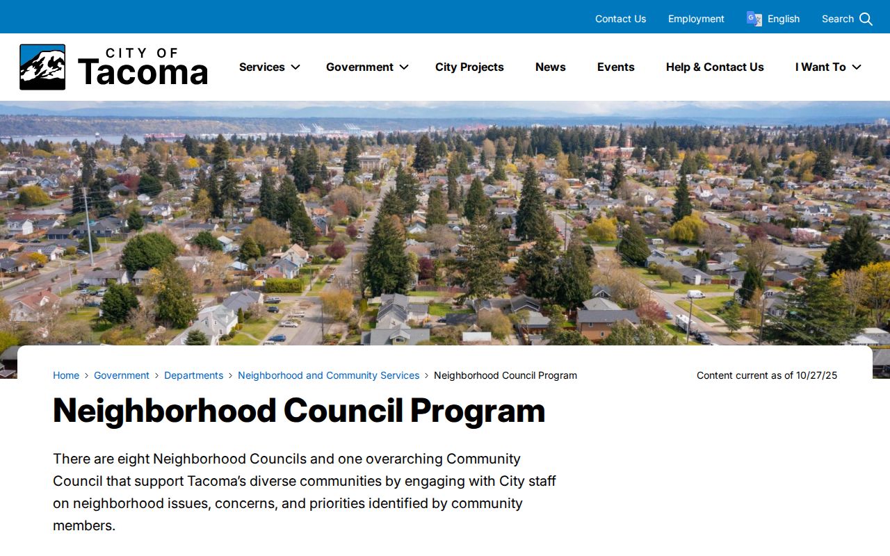
Use its council map and public contact routes to meet Tacoma neighbors through open civic channels, not to infer private membership.
Tacoma Voter Data Has Boundaries
Pierce County Elections handles local registration, precinct, and data-request routes. Public voter fields under RCW 29A.08.710 include name, residence address, political jurisdiction, gender, year of birth, voting record, registration date, and registration number, subject to protected-record rules. A voting record means participation, not how someone voted.
The county data form can request named districts or precincts, election matchbacks, a date range, and specified voting history. County research lists $5 per district or precinct file and $5 per day for matchbacks, with an active-voter default unless another scope is requested. The first response target is five business days. RCW 29A.08.720 limits list use to political purposes and bars commercial advertising or solicitation.
For an individual, Washington MyVote is the official starting point. Original registration forms, full birth dates, identification numbers, and Social Security number data are protected. Address Confidentiality Program participants receive substitute-address treatment. A voter address may lag a move, so it cannot settle who lives on a block today.
Tacoma Block Groups Are Not Rosters
Public household directories for Tacoma councils, homeowners groups, congregations, and block watches were not found in the researched official sources. A council contact is a community entry point, not permission to request or publish its private member list. The Tacoma-Pierce County Chamber directory can identify member organizations by category and distance, but it describes business affiliation, not nearby residents.
For historical context, the Tacoma Public Library ORCA collection includes selected house records, and the Northwest Room holds directories, maps, newspapers, photographs, architectural plans, and manuscripts. Those sources can explain how a block changed. They should not be converted into present-day claims. The 1888 Sanborn map, for example, dates a block's buildings and uses, not its current Tacoma neighbors.
Note: Ask a council for its next public meeting or public contact, not a private list of neighborhood households.
Official Tacoma Rolls Beat Compiled Profiles
Commercial neighbor tools combine material from many places. They may merge names, carry old addresses forward, or obscure the date and source of a claim. Official sources are narrower but easier to audit. A parcel card shows an owner field on a given date. A voter record has statutory limits. A council page shows public civic contacts. None promises a complete list of who lives nearby.
| Question | Official Tacoma route | Compiled commercial category |
|---|---|---|
| Which lots touch this address? | PublicGIS parcel map | Map method and update date may be unclear |
| Who is the tax-roll owner? | Assessor ATIP parcel record | May blend owner and occupant claims |
| What civic area covers the block? | City council program and county district layers | Neighborhood labels may be informal |
| Can a claim be corrected? | Contact the named public custodian | Opt-out and correction rules vary by provider |
Save the official URL, lookup date, and field label beside each fact. That record makes a later correction possible and keeps a narrow Tacoma neighbor search from turning into an unsupported personal profile.
Protect Privacy in Tacoma Neighbor Lookups
A tax roll omits renters and many household members. PublicGIS shows spatial relationships, not personal ones. Utility customer data, delivery records, and a public Tacoma household database were not located as open sources. Washington driver and vehicle records are confidential except through authorized channels under federal and state rules.
The Washington Address Confidentiality Program supplies a substitute address and mail forwarding for qualifying survivors and protected officials or workers. Do not try to infer an actual address from an older deed, directory, or voter entry. If a public record exposes a protected identifier, contact its custodian about correction or redaction rather than copying it.
Lawful use. Use Tacoma neighbor records for civic contact, local history, or personal safety awareness. Never use them to watch, threaten, intimidate, or harass another person.